Analyzing Transit
Vignettes of working with GTFS and transit-related census data in R.![]()

Vignettes of working with GTFS and transit-related census data in R.![]()
Creating a map of fare collection modes using NTD and APTA data.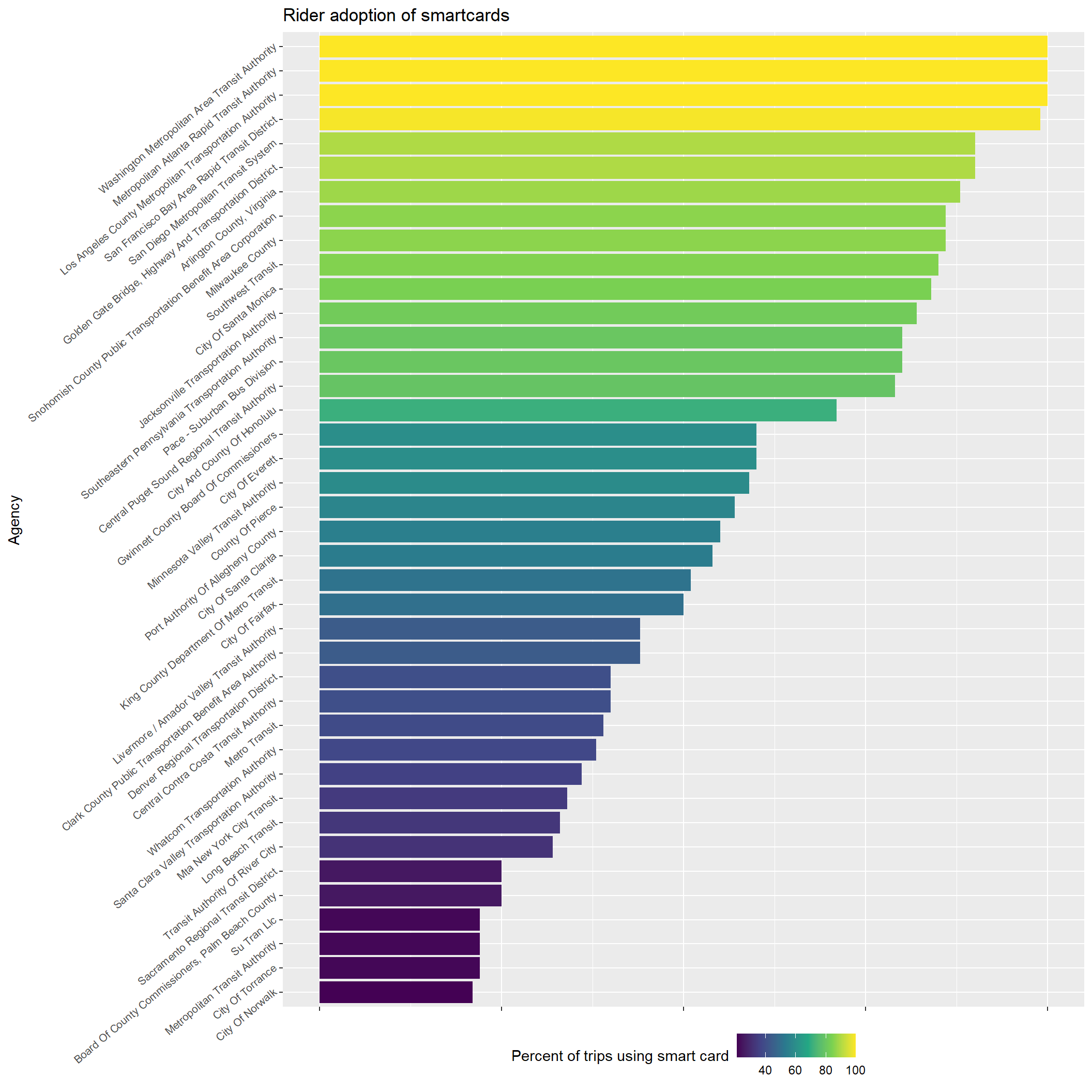
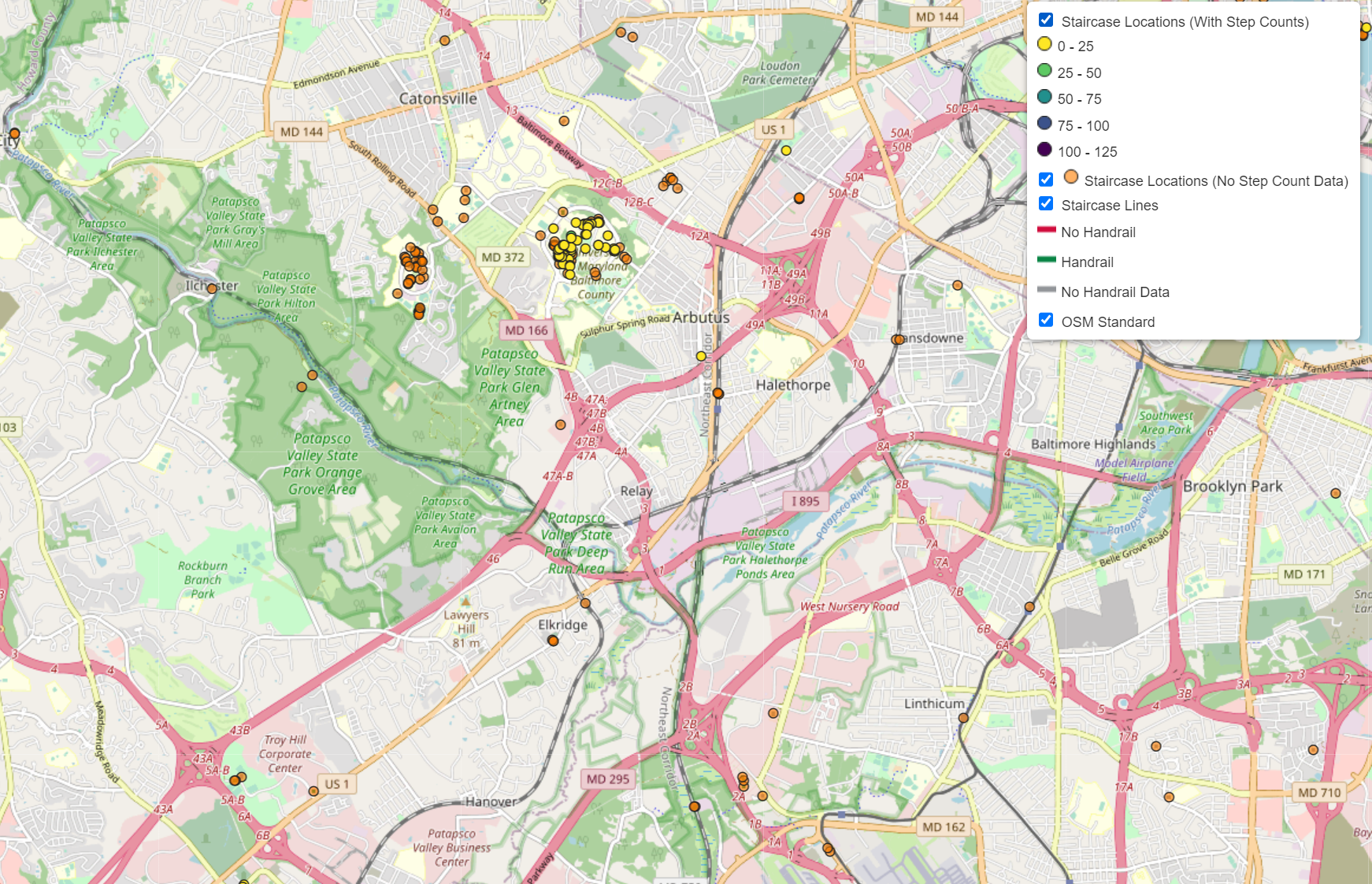
Interactive map of stairs in the Baltimore-Washington metro region.